Contents
The level of the rivers affected by the floods fell slightly on Tuesday night. An overview.
For today, Tuesday, SRF Meteo is forecasting further precipitation in the north. But the intensity of the rain is decreasing. Local landslides and debris flows are still possible due to the past wet days. In central and southern Ticino, the rain should subside in the morning.
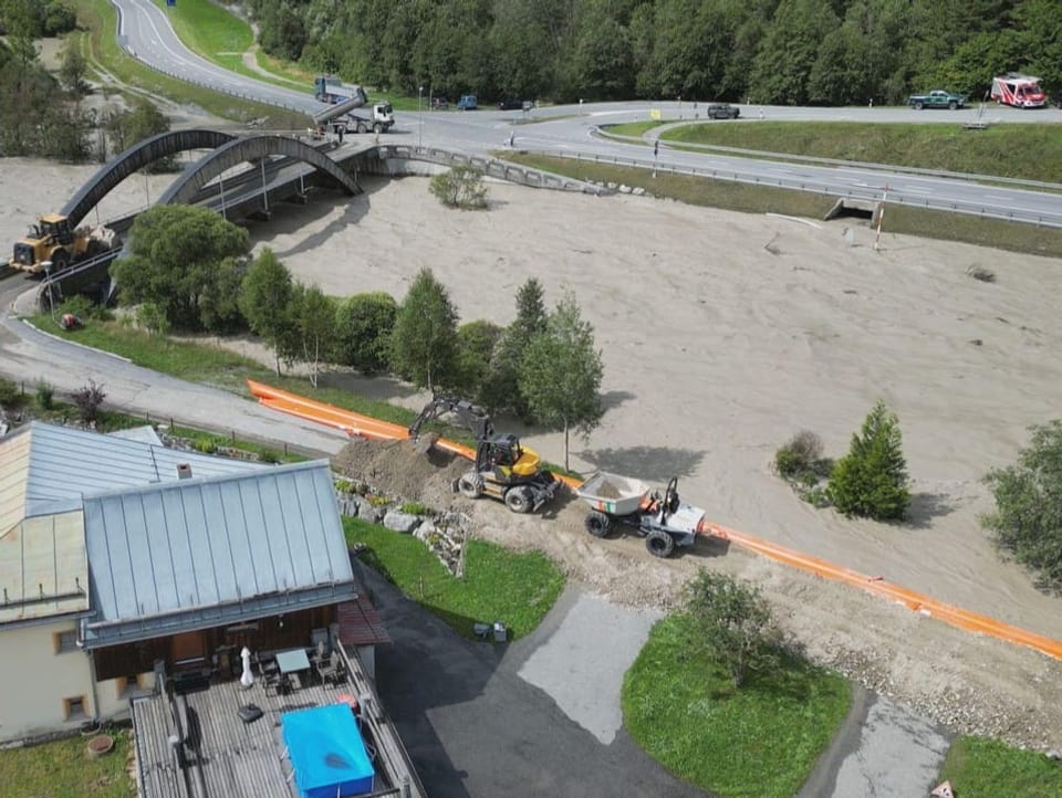
Grisons: The situation calmed down in Tarasp in the Lower Engadine. The Inn had meanwhile reached warning level 4. On Tuesday morning, according to SRF Meteo, the level was still at level 2. A campsite near Scuol was flooded on Monday. The rescue workers built emergency dams on the banks of the river. Several roads were closed. The road between Sils im Engadin and Maloja was closed because of a Rüfen decline. According to the Bündner civil engineering office, the connection to Vals was temporarily interrupted.
The Rhine briefly reached danger level 3 near Domat/Ems GR on Monday morning, but receded again in the afternoon.
In the village of Brienz (GR), which was evacuated in May because of an imminent landslide, the block falls increased and parts of the slide area above the village accelerated, as the municipality announced. This development was expected in view of the precipitation.
St. Gallen Rhine Valley: The Rhine flooded the Rhine foreland between Kriessern SG and the mouth of Lake Constance. However, the populated area was protected at all times by the outer dams, explained Ralph Dietsche, spokesman for the international Rhine regulation.
The peak of the water masses had already been reached in the afternoon, said Dietsche. According to him, up to 2000 cubic meters of water per second were calculated at Diepoldsau SG. The capacity of the Rhine with the Rhine foreland between the two outer dams is 3100 cubic meters of water per second.
The situation on the Rhine has weakened again, said Dietsche. The controls at the dams would be ended and the management staff of the Rhine regulation would be put back into standby mode.
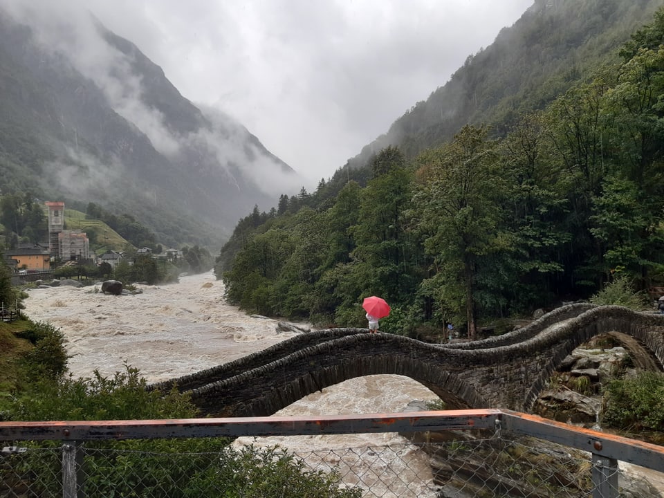
Ticino: In central and southern Ticino, it is sunny and mostly dry for longer on Tuesday with a strong northern foehn wind, as SRF Meteo reports. Previously, more than 360 millimeters of rain had fallen in Biasca from Saturday noon to early Monday morning. In addition to the Biasca region, the area around Locarno, the region around the Maggia and Verzasca valleys and the Riviera are also affected by the severe storms.
The level of Lake Maggiore has risen by more than a meter since Saturday. There was previously an absolute low water situation.
Glarus: A week ago, a landslide occurred near Schwanden GL in the Wagenrunse area. Over the weekend, the continuous rainfall has now exacerbated the situation. According to the authorities, the ground is heavily swollen, which is why the potential for danger is increasing.
Valais: In some of the southern Valais valleys, it snowed down to 1,600 meters, for example in Zermatt. There was 30 to 60 millimeters of precipitation almost everywhere in Valais on Monday, SRF Meteo reports.


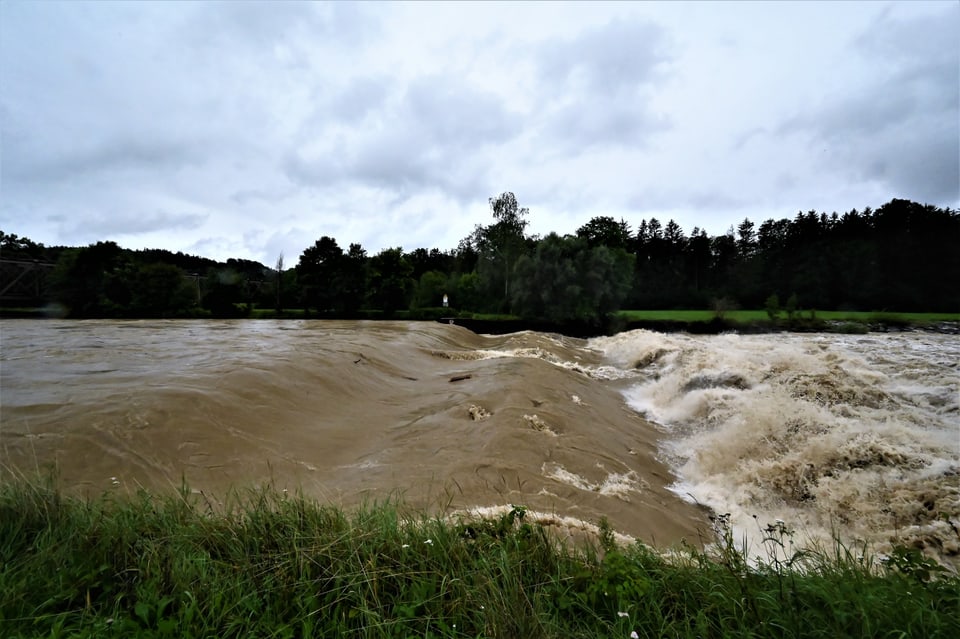
Thurgau/St. Gallen: The sitter near St. Gallen peaked around midnight, as SRF Meteo announced. The level of the Thur had also gradually decreased, it was said. The level of the Thur was in places – just like the sitter – at danger level 3, which means a considerable danger. However, the Federal Office for Civil Protection did not give the all-clear on the Alertswiss warning app early Tuesday morning.
Legend:
Alertswiss issued a flood warning for the Thur (image: from Eschikofen TG)
Albert Hurschler