contents
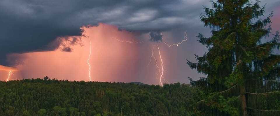
Heavy thunderstorms brought heavy rain, gusty winds and hail in places on Sunday evening.
A disruption (convergence) brought some strong thunderstorms on Sunday evening. The thunderstorms moved from Valais across the western Swiss Alps and foothills and further across the Alps of central and eastern Switzerland.
There were also some strong thunderstorms in the central and eastern part of the Swiss Plateau. In Interlaken/BE, 24 mm of rain fell within less than an hour, and in Visp there was a heavy gust of wind at 96 km/h. The weather gradually calmed down in the second half of the night. A total of 12,500 flashes were registered.
Thanks for all SRFMeteo pictures!
#SRFMeteoimages


traffic delays
On request, SBB announced early Monday morning that the route between Lenk and Zweisimmen in the Bernese Simmental was still blocked due to a storm. A replacement bus transports the passengers. In addition, there are no problems on the Swiss SBB network, said a spokesman on request.
Further development
Heavy thunderstorms are to be expected again this afternoon, especially in the foothills of the Alps and the Alps as well as in Ticino. Locally there is again heavy rain, squalls and hail. On Tuesday and Wednesday the chance of thunderstorms is significantly lower.