Christoph Ruckstuhl / NZZ
A photographic expedition to the outskirts of Zurich
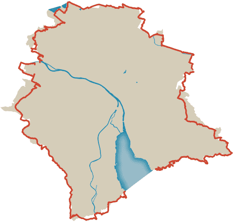
We all live within geographical borders, but we often don’t notice much of that in our daily lives. For example, you only become aware of a city limit when you leave the zones for which the public transport subscription is valid on the S-Bahn: it requires a surcharge. If you drive across the canton border in your car, thanks to the sign on the side of the road, you know that you have not only left the city, but also changed cantons: “Welcome to Canton Aargau”.
Where is the limit of the municipality in which you are registered and pay your taxes? Christoph Ruckstuhl, head of the NZZ photographer team, has been asking himself this question for a long time. He was born in Zurich and has spent almost his entire life here. He is familiar with many paths in this city, and they are always the same. Now he wanted to break new ground.
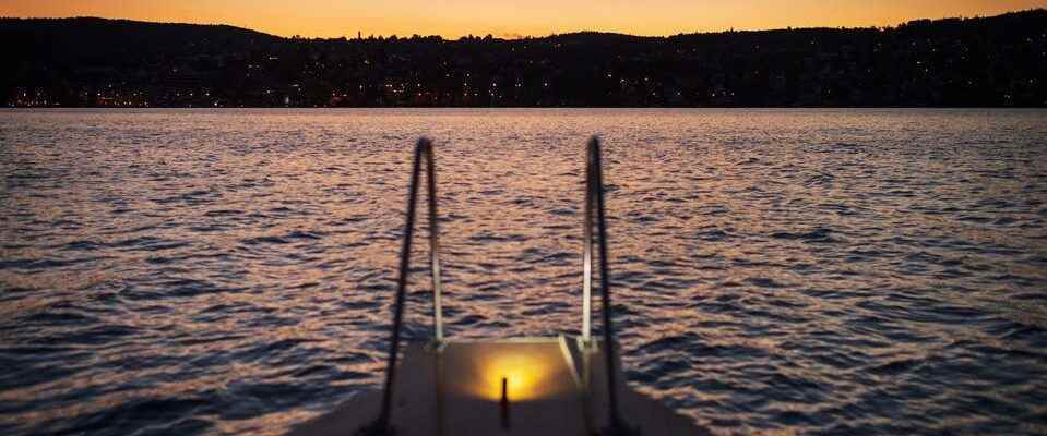
So, early one morning at the end of July, Christoph Ruckstuhl, equipped with his camera, set out to walk the city limits. He would document his border crossing with pictures; Images of places, people and things he sees as he walks along the city limits. Sometimes it was the view of the city that he took with him from higher ground.
He tried to follow the border that Zurich marks on the Swiss map as closely as possible. His cell phone showed him the way. He had to deviate where the border is in the water, over the freeway or through the thicket. In a cemetery, the border ran right across a grave. Green and concrete alternated: here the extremely urban Zurich, there the photographer was back in the middle of nature. He didn’t expect this stark and frequent contrast, he says.
The city of Zurich is 58 kilometers long at its edges. Christoph Ruckstuhl ran a total of 65 kilometers and was on the road for eight hours on each of three days. The photos you see on these pages tell of his border crossing. Sometimes poetic, sometimes humorous, sometimes bizarre, they depict the boundary that defines our political, but also emotional affiliation with a place.
With this photographic journey of discovery, Christoph Ruckstuhl is retiring from the NZZ at the end of August after more than 22 years.
From the lake to Stettbach train station
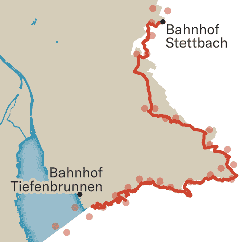
From Tiefenbrunnen it first goes through residential areas to Rehalp. The path continues to climb. We dive into lush greenery and a dense network of hiking trails. Through a ravine and across meadows we reach the forests on the Adlisberg and the Loorenkopf. A few steps down the hill you can already see the houses of Stettbach. The city has us again.
From Stettbach to the Limmat
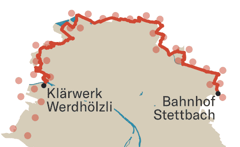
A section with great diversity: first sporty and masterful on the Heerenschürli, then big-city loud along the autobahn. Allotment gardens are in close proximity to urban housing developments and industrial facilities. And suddenly everything is contemplative, quiet and rural again: On the way to Katzensee, a buffalo calf makes its first attempts to walk in a pasture. Through nature reserves and over the Hönggerberg we reach the Limmat, where the Böötler cavort.
Via the Üetliberg to Lake Zurich
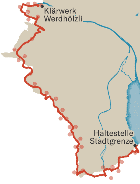
This is a mountain stage. Initially still harmlessly flat, it goes through industrial areas and past soccer fields. At the community gardens, however, the terrain rises steadily up to Uitikon. But then it gets rough at times, and the Üetliberg takes its toll. The 870 meters mark the highest point in the city. Via the Gratweg and the Risweg we leave the local mountain steeply down to Leimbach and the Sihl. Past the Entlisberg and via Wollishofen down to the lake and to the bus stop with the descriptive name: «City Limit».