- Up to half a meter of fresh snow has fallen in the Alps in the last 24 hours.
- The Federal Office for Natural Hazards warns of a significant danger from snow for the weekend.
- The railway line between Täsch and Zermatt in Valais had to be closed due to an avalanche.
- Many roads at high altitude are covered with snow, such as the approaches to the Gotthard and San Bernardino tunnels.
Winter is sweeping across Switzerland again this weekend. A lot of fresh snow has already fallen, especially in Valais: in Zermatt it has been 50 centimeters so far. The federal natural hazards department had already warned of the significant danger of snow during the night.
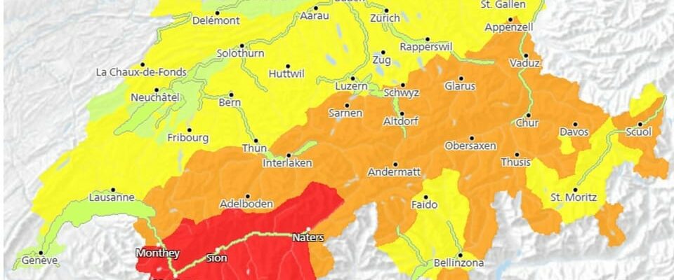
In parts of Valais, the danger from avalanches is considered to be high. That is why the specialist department there has declared danger level four. This concerns the region around Sion.
The railway line between Täsch and Zermatt had to be closed due to an avalanche. The duration of the disruption was initially unknown, as the Matterhorn Gotthard Bahn (MGB) announced on Twitter.
Nothing was initially known about the extent of the avalanche and its consequences. When asked, the Valais canton police pointed out that the road to Zermatt was also temporarily closed. The reason was preventive avalanche blasting.
The sometimes heavy snowfall also causes obstructions on the roads elsewhere, for example on the north-south axis, like the TCS on its homepage writes.
At the same time, there has been a risk of forest fires in Graubünden and parts of Ticino since Friday. Therefore, in the affected regions, the barbecue may only be kindled in existing fireplaces.
Snow line in the morning partly at 400 meters
In the Alps will it rain or snow again and again today? Most precipitation occurs in the western and central Alps, especially in the Lower Valais. The snow line is initially between 600 m in the east and 1200 m in the west and rises again in the evening from the west. The maximum temperatures are between 4 and 8 degrees, at 2000 m -3 degrees. A strong westerly wind is blowing on the mountains.
In the Lake Constance region to Lake Geneva, Jura and in the Basel region It is mostly cloudy and rain or snow falls in many places, especially in the morning. The snow line in the morning is between around 400 m in the east and 1000 m in the west and rises again in the afternoon.
In the south it looks different: In Ticino it is partly sunny with maximum values of up to 18 degrees.
Once the cold weekend with snowfall in the Alps is over, the temperatures will rise sharply at the beginning of the next week. On Monday, 18 degrees Celsius can already be expected on the north side of the Alps.