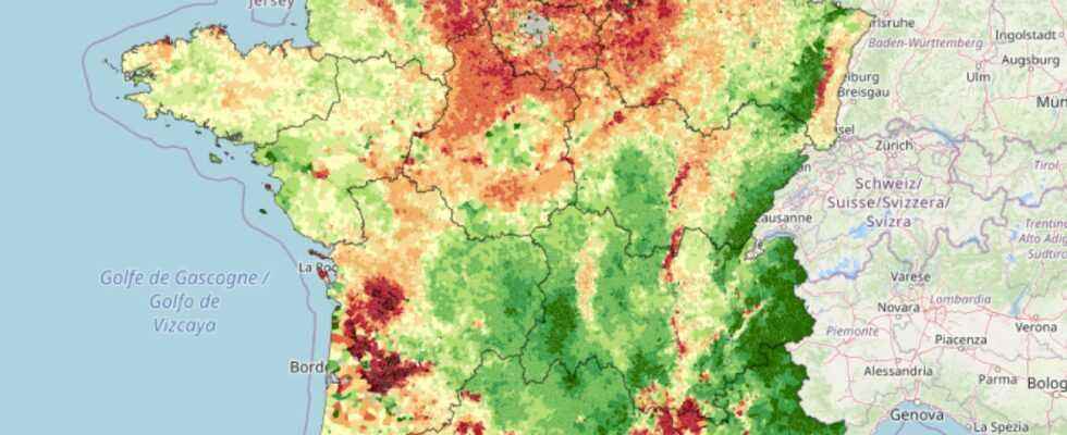
Solagro has gathered French data on pesticides in the form of a map of France accessible to everyone. This makes it possible to visualize the level of pesticide use, commune by commune.
The use of pesticides gives rise to data that can be followed throughout the territory. The associative company Solagro, which supports energy and agroecological transition projects, has compiled all this data in the form of a map of France. It is available on their site.
Solagro gave the nickname “Adonis” to this map, in homage to the plant of the same name, which is endangered due to the intensive use of herbicides. ” The Adonis card aims to bring to the attention of all municipal data on the use of pesticides “explains the site.
The IFT index for pesticides
The colors of the map correspond to the communal phytosanitary treatment frequency index (IFT), which estimates the level of pesticide use for the communes, ” on the basis of the rotation of the municipality, the type of practice (conventional or organic) and the regional reference TFIs from statistical or local data “.
This therefore indicates the average level of pesticide use at the commune level. The darker the red, the higher the index. The same map also makes it possible to look at the specific IFT of the herbicides. More positively, it is also possible to look at the presence of organic farming by municipality.
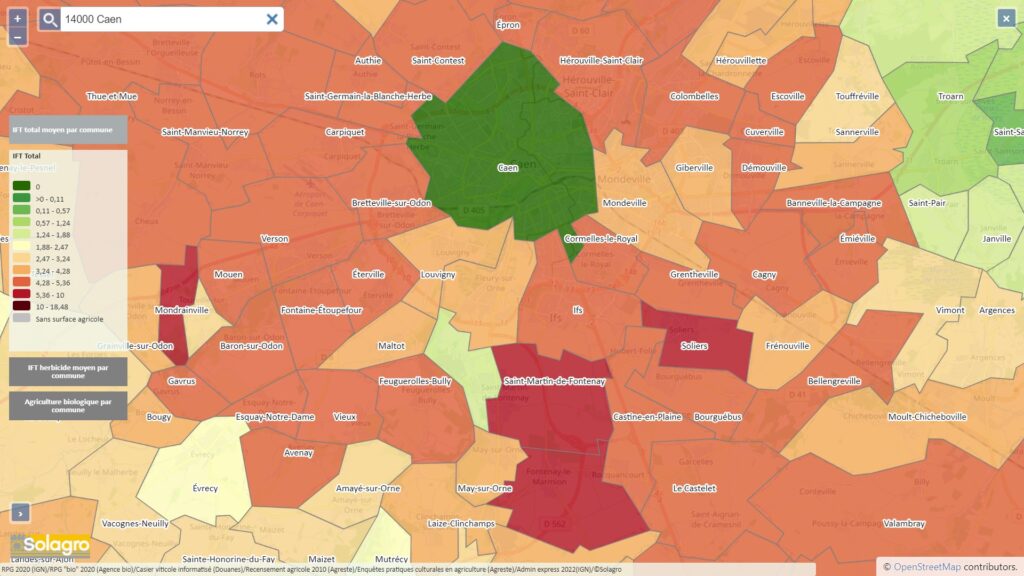
To look in detail, the map also allows you to zoom in by entering a specific municipality to observe.
” Faced with environmental and public health challenges, it is necessary to build sustainable agriculture that uses less inputs and respects natural resources and to provide the French with quality food to reduce the prevalence of chronic diseases. », Specifies Solagro on its site. This cartography can be used by everyone, but can also be used in the context of scientific research or in the definition and evaluation of public policies.
