
From this Friday, July 8, Apple is rolling out its new Maps mapping in France and Monaco. Navigation improves as well as the modeling of buildings and environments. Trip planning tools, guides or even more immersive instructions are on the program for the update.
Several months after deploying its new version in the United States, Apple Plans is finally heading to France. The update is available from this Friday, July 8 for all users in mainland France and Monaco.
After having crisscrossed France with its small cars that have come to map everything, Apple is finally offering a more precise version of its maps, with better modeled buildings, more detailed environments and all in 3D. The main road network as well as the secondary roads and the streets of the most important French cities are affected by this major update.
A Google Street View function with Apple sauce
The new version provides more precise mapping of highways, national, departmental and others. You will also find recognizable buildings among a thousand, especially for cultural monuments and public establishments. The Eiffel Tower or the Louvre Museum are immediately recognizable on the navigation map, as is the Monte-Carlo casino in Monaco or the citadel of Carcassonne.
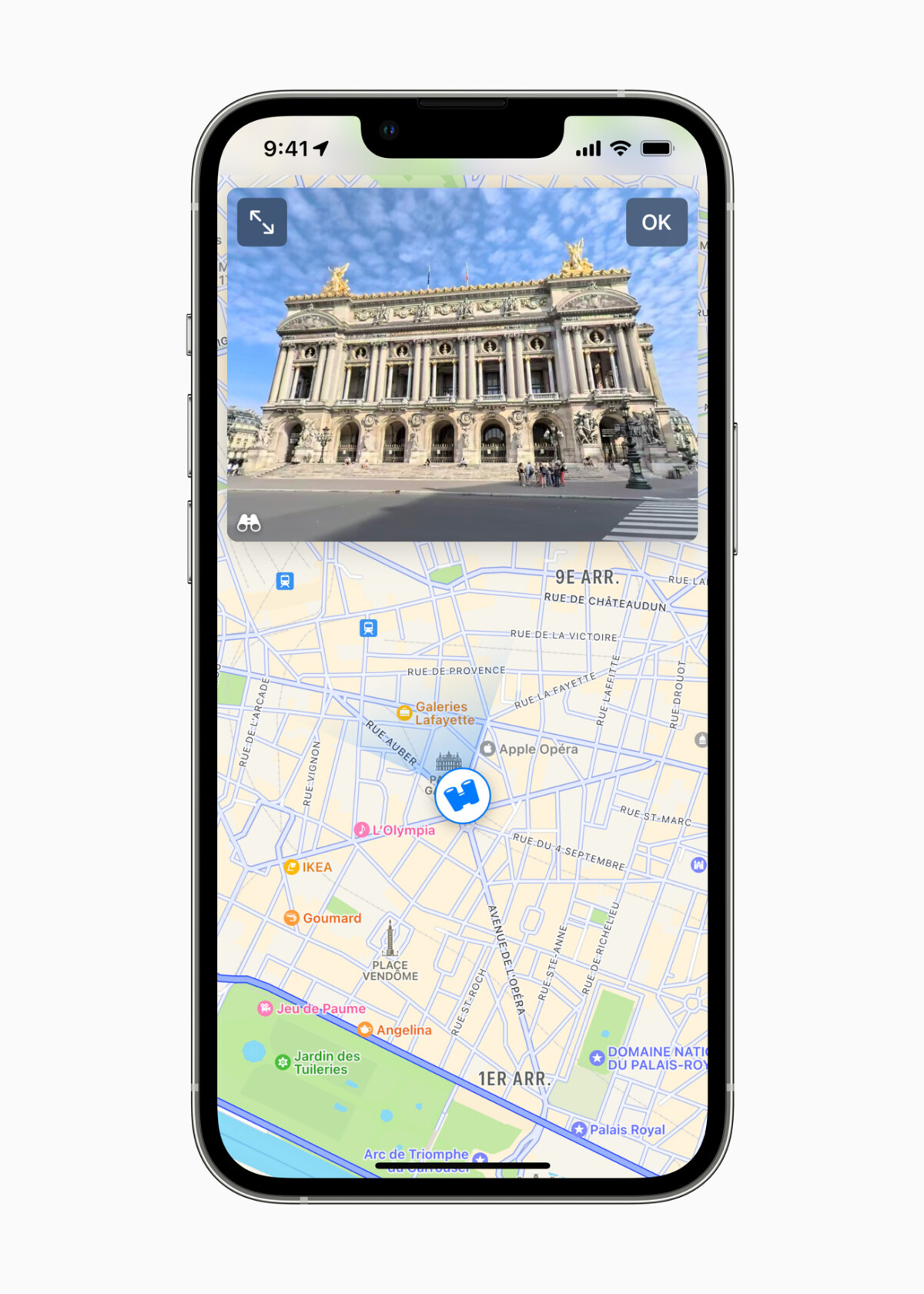
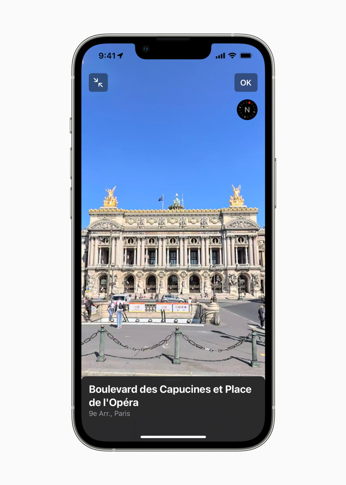
The overhaul of Maps involves better identification of places and monuments as well as roads, forests and rivers. This greatly helps navigation with much more detail available, views of landscapes, some of which can be viewed even before setting off thanks to the look around which allows you to have a 360° view of places like Google Stree View.
This is also accompanied by information on places, tourist guides or multiple data on a site such as an area to visit. The 360° view will also prove to be a real tool for getting to know a place before even moving and identifying the points of interest to add to a personalized tourist guide, a sort of great list of things to do. see or do.
Hey Siri, what are we going to visit?
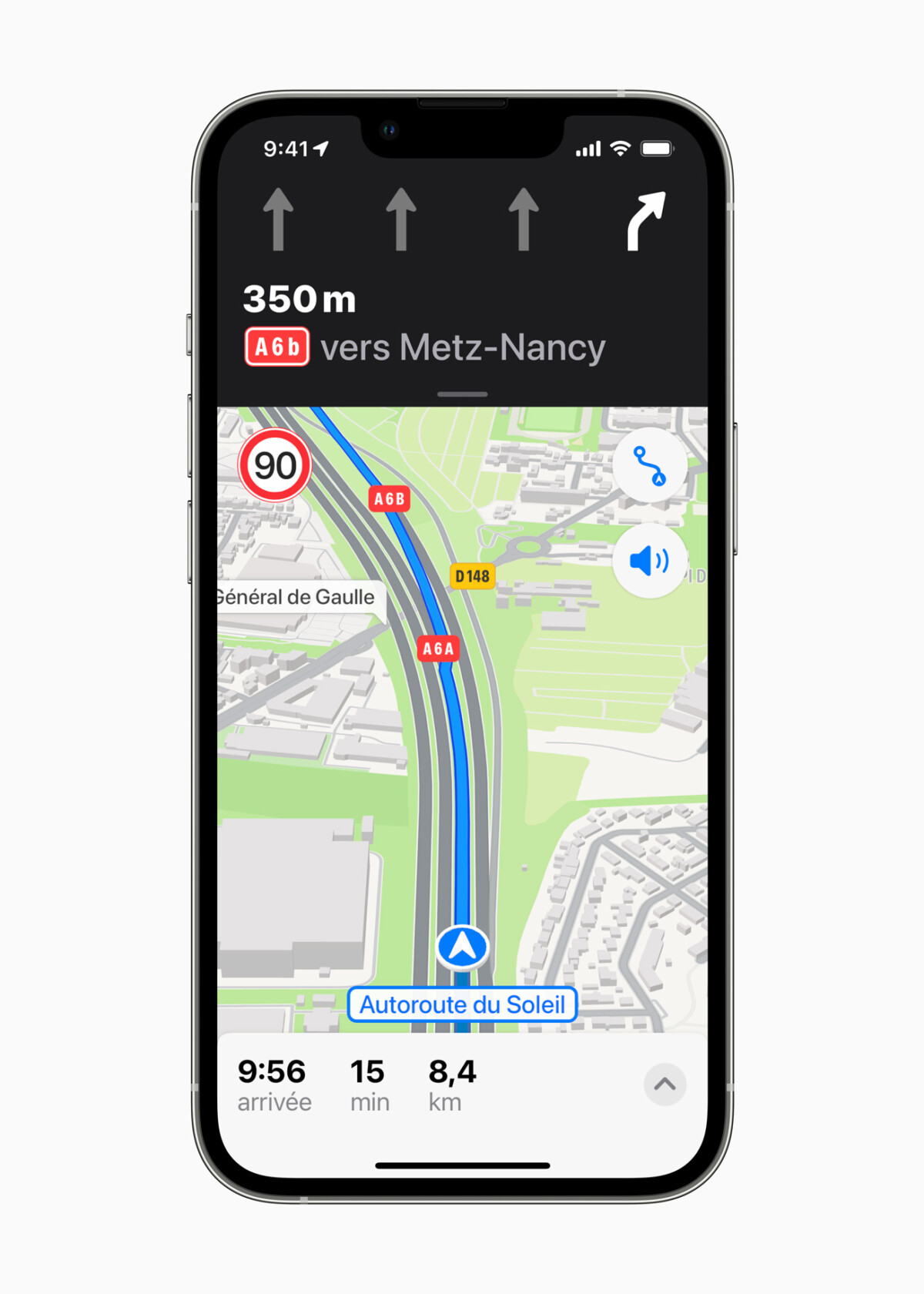
It is in particular the use of Siri which is improved. The indications are more detailed in particular on the way to be taken or the direction according to the elements. The voice assistant will indicate in particular the central, right or left lane to take to follow, whether to turn before or after the traffic light, to facilitate your navigation. Everything can be done by voice, in natural language, in order to have the most precise indications possible. No more reason to get the wrong direction, which exit to take or which lane to turn. Plans also adds information on traffic in real time or the speed to respect.
Aware of the delay of its application compared to Google Maps, Apple has therefore accelerated and the new Maps multiplies the new functions to improve not only navigation, but also the use of the app to create guides. personalized use with your recommendations of places to visit, plan your trips with management and preparation tools as well as a 360° vision of future places visited. You can, like on Waze, tell your loved ones what time you plan to arrive by simply sharing your route and therefore the estimated time of arrival.
360° view
To enrich the maps in the way Waze does for its own or for Google Maps, you can report an incident, a danger on the road or any other indication, even stating it to Siri with a simple “There is an incident“.
Who says cartography and navigation says both road and transport. The stops will be much better mentioned. You will also be able to indicate your favorite lines or obtain information on your iPhone or your Apple Watch in order to know when to prepare to get off the train. If the indications concerning the bicycles will gradually enrich the application, the pedestrian data are already taken into account. Apple Plans will thus refine the walking routes for several cities such as Paris, Marseille, Lyon and Nice. The iPhone can be used to scan the buildings in the area so that Plan identifies them to enrich its navigation and offer ideas for exploring the area.
But Maps doesn’t just want to be reduced to point A to point B usage. The app adds several features to reinforce usage. It will provide information on the altitude level in the city for different cities such as San Francisco, Los Angeles, Montreal or London. The Flyover function will allow you to fly over a 3D city modeled in photorealism for more immersion, whether streets, historical sites, streets, in panorama as a simple view. Some French airports and shopping centers will also offer interior plans to avoid getting lost with even the locations of toilets like shops and restaurants.
Siri will also be able to scan your calendars, reminders, emails, etc. in order to always have relevant information to provide on your next flight, the direction of the airport, the direction to the terminal, what time to arrive there and board, or even in real time all the data on your flight.
To follow us, we invite you to download our Android and iOS application. You can read our articles, files, and watch our latest YouTube videos.