A few days after the devastating volcanic eruption of the Hunga Tonga-Hunga Ha’apai, satellite images give a first impression of the destruction caused in the island state of Tonga. The footage is from a preliminary damage assessment report for the United Nations.
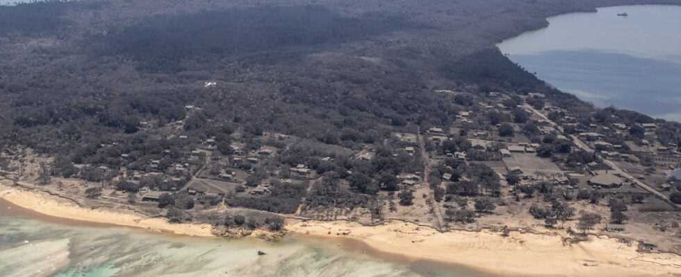
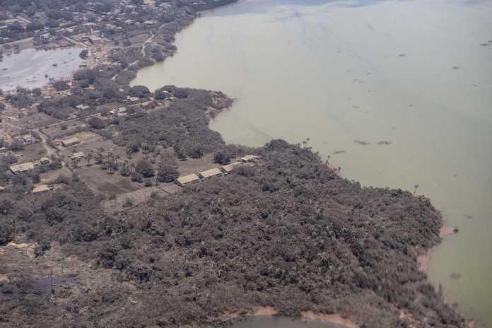
You can see not only the almost completely destroyed island above the volcano itself, which was only formed in recent years, but also settlements on islands in Tonga, where the ash layer is particularly noticeable. Traces of the tsunami, which was triggered by the volcanic eruption and was able to penetrate far inland on the flat islands, are also visible. Aerial photographs from the New Zealand military confirm this.
Cut off from the rest of the world
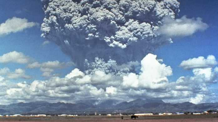
The volcanic eruption on Saturday was probably the strongest in the world for at least 30 years and not only heard thousands of kilometers away, but could also be understood from air pressure measuring stations worldwide. A massive cloud of ash had been thrown miles into the air and was clearly visible to satellites.
Not only the submarine cable connecting Tonga to the rest of the world, but also a domestic cable between the islands had been severed as a result of the eruption. Contact with the outside world is currently only possible via unreliable satellite connections, which is why it is difficult to estimate the full extent of the damage. It is also unclear how many victims the eruption has claimed.
Images from various Earth observation satellites now show entire islands covered in ash. Buildings are therefore harder to identify, which is why it is sometimes unclear whether they were destroyed. Flooded streets can also be seen, and in places it is clearly visible how far the seawater has penetrated. Whole rows of buildings seem to have been destroyed, especially on beaches. The images show parts of the islands of Tongatapu, Uoleva, Uiha and Nomuka. Tonga consists of a total of around 170 islands, 36 of which are uninhabited.
Even more impressive are the first aerial photographs that the New Zealand military have made public. That had undertaken the first flights not only to be able to estimate the extent of the damage, but also to bring relief supplies to the islands. Because of the layer of ash, planes cannot currently land in Tonga, and there are currently no cases of Covid-19 in Tonga, which is why direct contact should be avoided.
Tonga has a total of around 100,000 inhabitants, the capital Nukuʻalofa is on the island of Tongatapu. Photos of the damage and large debris allegedly taken on the islands of Lifuku and Haapai, said to have been sent via a satellite link, were also collated in a post by radio technology site DX-World.
The United Nations are currently particularly concerned about the low-lying islands of Mango and Fonoi, reports the dpa. A distress signal was received from Mango. The New Zealand government, citing the police in Tonga, said that two deaths had been confirmed so far.
New Zealand sent two ships with relief supplies to Tonga, 2,300 kilometers away, on Tuesday. There is no request for help yet, but since the ships need three days, they should already be on their way. If not needed, they would return. Among other things, they should bring drinking water to Tonga. The HMNZS Aotearoa can transport 250,000 liters and produce 70,000 liters per day through a desalination plant. It is still unclear whether the volcano is now calm. Experts believe further outbreaks are likely.

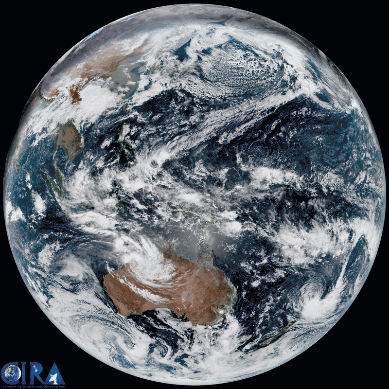
The volcanic eruption in Tonga from space (seen right below)
(Image: RAMMB/CIRA)
(mho)