contents
After “Ylenia” and “Zeynep” the next storm follows today.
the essentials in brief
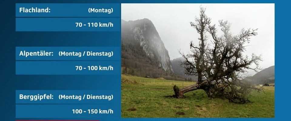
- Storm low “Antonia” causes storm and hurricane gusts in the lowlands, especially on Monday, in the mountains and in the Alpine valleys until Tuesday
- On the mountains between Sunday evening and Tuesday 100 to 150 km/h locally
“Antonia” meets Switzerland on Monday morning
The strongest winds moved across the lowlands with the cold front on Monday morning (see table below). During the day it stays windy. In the mountains and in the Alpine valleys, the peak is sometimes not expected until Tuesday night. The strongest gusts are between 70 and 100 km/h and on the mountain tops there are 100 to 150 km/h.
Legend:
SRF storm warning
SRF Weather
fresh snow
The cold front associated with the storm will also bring rain and snow. In the Alps above 800 m altitude, 20 to 60 cm are expected until Tuesday. Local differences will be large due to snowdrifts.

Legend:
fresh snow
From Monday morning to Tuesday morning, the north-west to north stagnation will bring 20 to 60 cm of fresh snow above 800 m.
SRF Weather
Stormy for the past few days
Several storms have swept over Europe in the past few days. After “Ylenia”, hurricane “Zeynep” raged in Great Britain on Friday and then moved over the Benelux countries and northern Germany. Internationally, the hurricane is known as “Eunice”. In southern England, at 196 km/h, it led to what was provisionally the strongest gust ever measured in England. Switzerland was significantly less affected by “Zeynep”. But also in Switzerland there were gusts of 60 to around 90 km/h in the lowlands on Saturday night. In the mountains, the strongest gust was measured at 117 km/h on the Säntis.