Supercell thunderstorms, or thunderstorm supercells, are very violent weather phenomena. It is one of the most dangerous storm structures.
A ” extreme thunderstorm risk concerns part of France this Tuesday, July 11, 2023. Violent thunderstorms are expected to break out in the afternoon, in the north-east of the country, while 9 departments have been placed on heat wave orange vigilance. The situation is unusual in France: for the first time since 2014, the Keraunos observatory (the French observatory for tornadoes and violent thunderstorms) indicates a risk of thunderstorm ” extreme ” In France. The first thunderstorms should take the form of supercells before the arrival of a ” multicellular tendency “, according to the observatory.
The consequences of a tornado resulting from a “supercell storm” can be impressive and devastating: damaged houses, homes without electricity, flooded streets.
But, what exactly is a supercell storm?
How does a thunderstorm supercell form?
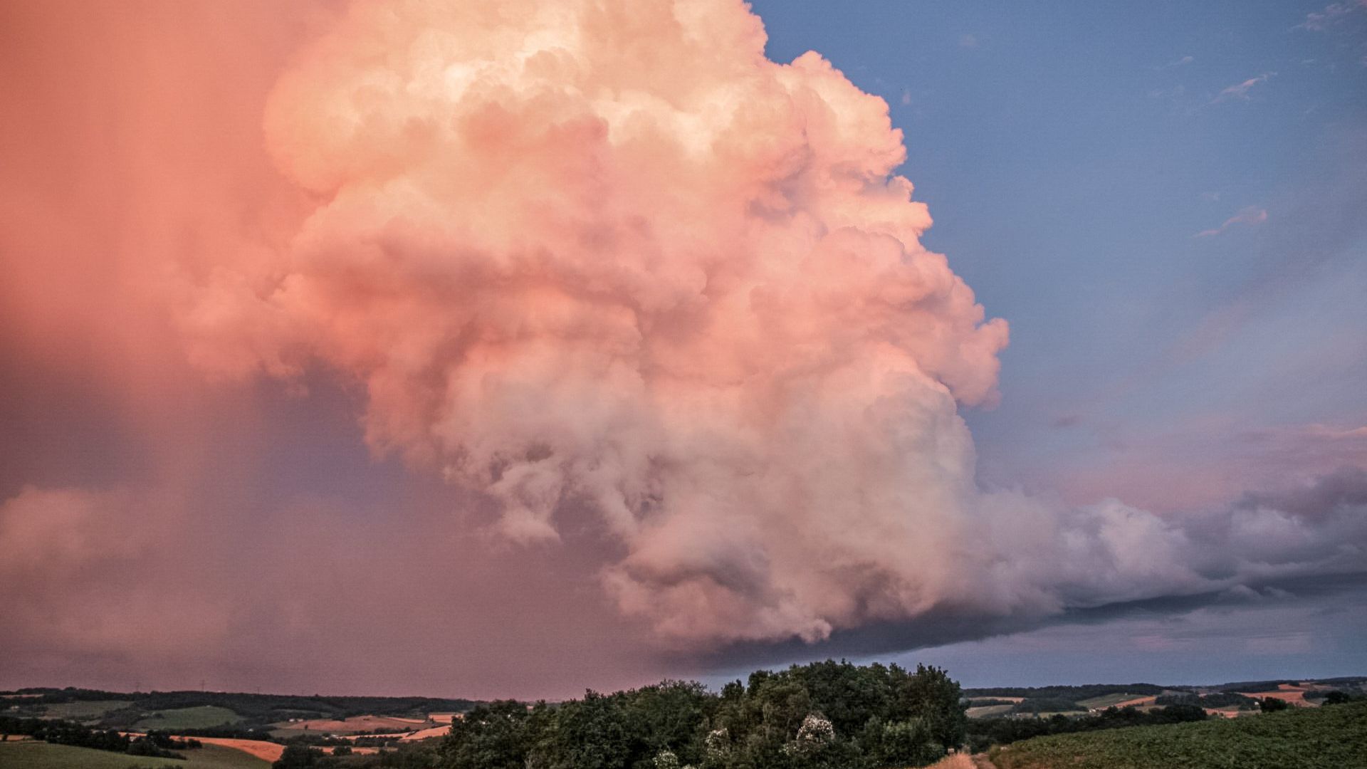
A supercell thunderstorm, or thunderstorm supercell, is a special type of storm, made up of a single, self-contained convective cell.
The stormy supercells contain updrafts that rotate around a vertical axis “Summarizes the American Agency for Oceanic and Atmospheric Observation (NOAA). This rotational movement is caused by a change in wind direction and/or speed with altitude around the growing storm. This wind shear leads to the formation of a mesocyclone, a rotating updraft: this rotational zone can have a diameter of 3 to 10 km.
Supercells are associated with other severe events, such as damaging winds, tornadoes and large hailstones. “Most strong to violent tornadoes are associated with supercells.s,” according to NOAA. The supercell is described as ” the most virulent and dangerous storm structure of all », by Keraunos, a French company specializing in the observation of tornadoes and violent thunderstorms.
How to recognize a thunderstorm supercell?
These phenomena often occur in May or June. They have impressive dimensions. They look like very high clouds, forming an “anvil” at their top, which extends very far. ” A true wall of precipitation is usually visible a few miles away and is the visible manifestation of the downdraft of cold air », summarizes Keraunos.
In extreme circumstances, a supercell storm can move at speeds of 65 to 80 km/h.
How long does a supercell storm last?
After forming, a supercell can survive for a long time, even if it crosses an area not conducive to the formation of more typical thunderstorms, according to NOAA. Supercell thunderstorms can last for several hours in a favorable environment, estimates the United States Weather Service.
The longevity of thunderstorm supercells is explained, as Keraunos points out, by the ” spatial lag between main updraft and downdraft of cold air “. The rising hot air is not cooled by the downdraft.
Where do supercell thunderstorms occur?
Supercell thunderstorms have been observed in several regions of the world, especially in Europe, the United States, and South Africa.
Supercell storms can occur in France, as was the case on Sunday June 18, 2023. In May 2022, Indre experienced a supercell storm, during which hailstones 10 cm in diameter fell from the sky, an exceptional event. In France.

Do you want to know everything about the mobility of tomorrow, from electric cars to pedelecs? Subscribe now to our Watt Else newsletter!