Contents
Uri has one of the most comprehensive avalanche chronicles in the entire Alpine region. The map is now publicly viewable.
They are called Chlauserli Steglaui, Kirchberg Missli or Grithäle. They are among the 5,000 avalanches that have fallen and been recorded somewhere in the canton of Uri over the past 100 years. People in the mountain canton of Central Switzerland have always been threatened by avalanches in the winter months.
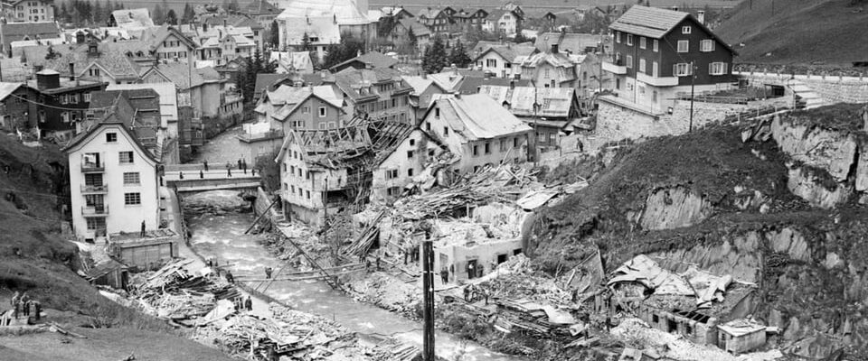
One of the most devastating avalanches in the canton of Uri occurred on January 20, 1951 in Andermatt. The “White Death” tore 13 people from their lives. The violence of the avalanche left a devastated village.
Legend:
In 1951, masses of snow thundered through the middle of Andermatt. The natural disaster still leaves deep wounds in the people who experienced it.
KEYSTONE/PHOTOPRESS ARCHIVE/STR
To protect people from avalanches as best as possible, the canton of Uri has been documenting avalanche events in great detail for a good 100 years.
The foundation stone for this chronicle was laid by the former head of the canton of Uri, Max Oechslin, and his son Karl Oechslin, then head of the avalanche protection department. Between 1920 and 1989 they recorded many avalanches.
“Max and Karl Oechslin are actually the inventors of this avalanche database,” says Lukas Eggimann, head of the natural hazards department in the canton of Uri. “They held talks with the population, with farmers and with forest workers.” They have collected and cataloged this knowledge. Documents from various archives were also evaluated.
A work that never ends
The Uri avalanche chronicle is constantly updated. A lot has come together since 1920: Up good The collected photos, sketches, reports or notes of around 5000 registered avalanche events are recorded on 2100 pages.
The avalanches are also neatly marked on maps. This is how the avalanche atlas of the canton of Uri came about. This was previously only visible to the administration. That has now been changed.
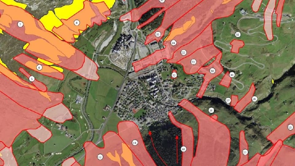
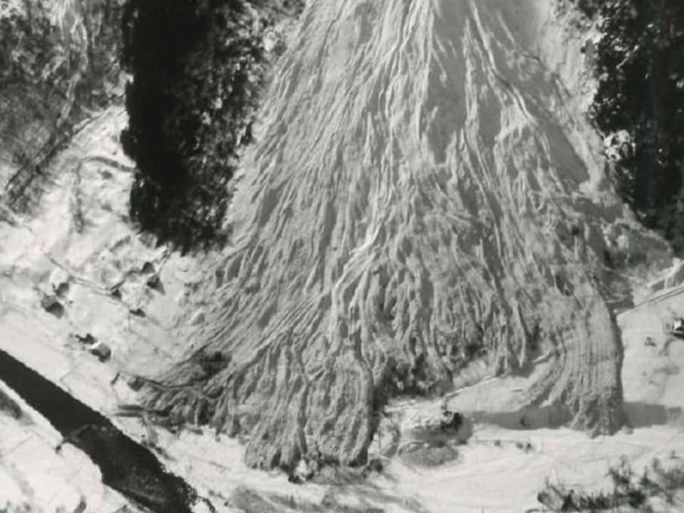
Legend:
Section of the avalanche atlas. The avalanches around Andermatt are shown here.
ZVG/Canton of Uri
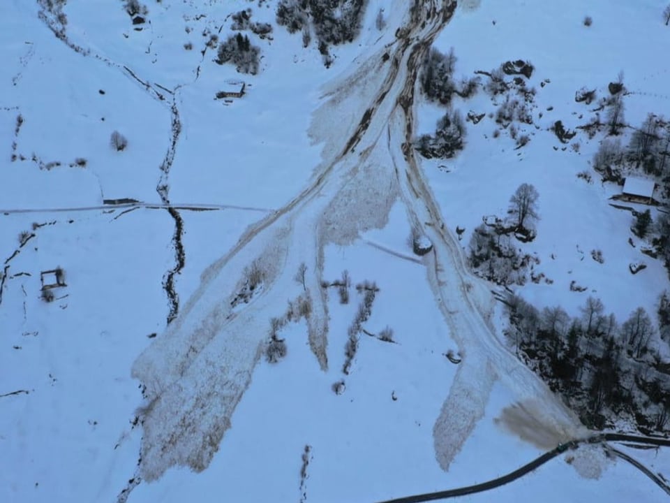
The maximum extent of the avalanche is shown in each case. But there are two things you have to consider if you want to find out more about the geoportal, says Lukas Eggimann.
The avalanche register is not complete: “Avalanches outside of populated areas are less well documented and sometimes not documented at all.” Only avalanches that have caused damage or have been accidentally observed and reported by people are recorded there.
Structural measures taken
Also important to know: “Avalanches are also marked on the map, which nowadays can no longer spread so far or can no longer occur at all. We have built avalanche barriers, reforestation and protective structures in many places,” says Eggimann.
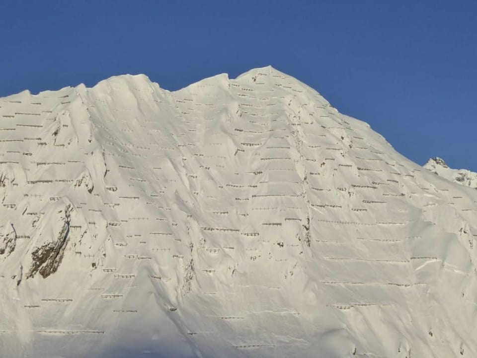
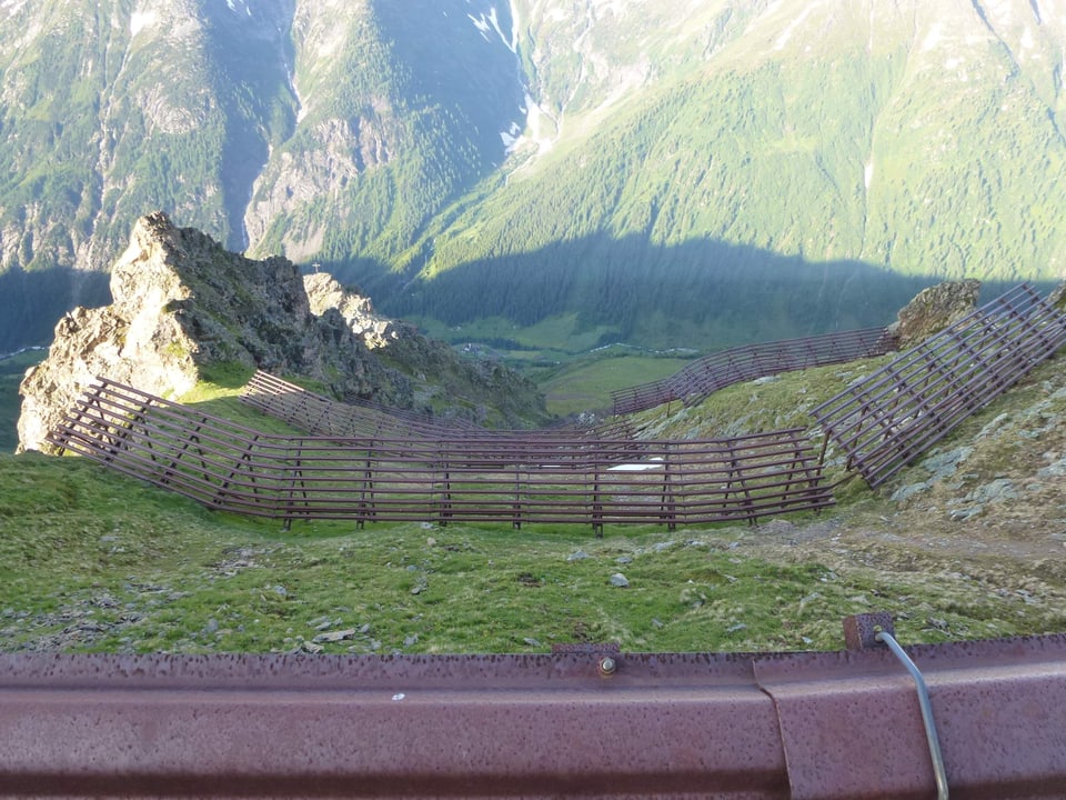
This is exactly why the avalanche atlas is invaluable. Knowledge of past avalanche events is the most important basis for effective protection against avalanches.