contents
Again and again there are catastrophes with crumbling mountain flanks or glaciers. This is why monitoring is so important.
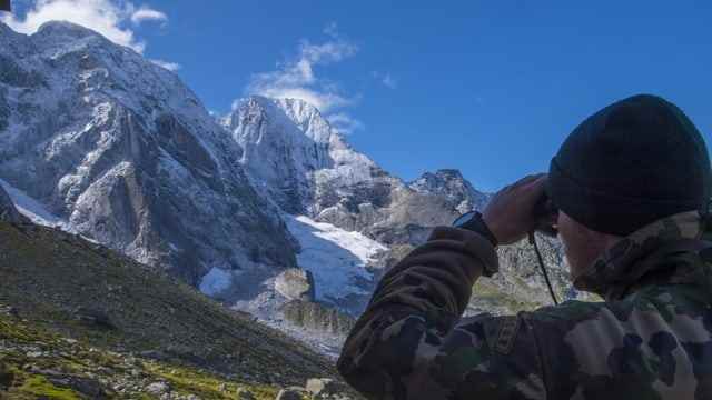
Florian Amann clearly remembers August 23, 2017, when the landslide on Piz Cengalo happened. At the time, he was working as an engineering geologist at ETH Zurich and used a mobile radar device to measure the unstable mountain flank on Piz Cengalo once or twice a year.
The landslide went just as far as we had calculated.
Based on these measurements, as early as 2014 he and his team calculated various scenarios of how big a landslide could be and how far down the valley it would fall – with surprisingly high accuracy. “The landslide actually went as far as we had previously calculated,” says Amann.
One of the reasons he and his team were able to make the forecasts so accurately is that the Piz Cengalo has been known to be unstable for years and a large rockslide occurred on the steep north-east flank back in December 2011. After that, the mountain began to be surveyed at regular intervals.
Satellite measurements help
But how can mountains, slopes and glaciers be found that are becoming unstable? Help comes, among other things, from space. Andrea Manconi, environmental engineer at the Avalanche Research Institute in Davos (SLF), works in depth with satellite measurement data. Above all, radar measurements, which can also be made in cloudy weather or at night, are very interesting, he says.
In this way, remote areas could be monitored virtually on the computer. Measuring instruments on board satellites transmit radar waves in the direction of the earth’s surface. There, the waves are reflected and sent back to the satellite in slightly modified form. Researchers can use these waves to calculate whether the terrain is moving at a certain point.
Suitable as a pre-warning system
The method works well for slow slides. Faster movements cannot be measured correctly in this way, but at least you get indications of unstable areas.
This is how researchers became aware of the Moosfluh, for example, a wide flank directly above the retreating Aletsch Glacier. After decades of slipping just a few millimeters a year, the slope suddenly dropped by several meters in 2016. As a result, measuring devices were installed on site and hiking trails through the area were closed.
Melting permafrost or melting glaciers upset the balance. How exactly, we don’t know yet.
The satellite measurements are becoming more and more precise, says Manconi. He expects that unstable mountains and glaciers will be able to be monitored even better in the future.
It doesn’t always work with satellite
However, satellite measurements would not have helped on the Piz Cengalo. The dangerously crumbling, vertical north-east flank is simply too steep and therefore a blind spot for radar waves from space.
But the landslide of 2017 provides important clues as to what role the consequences of climate change can play when mountains become unstable. A lot of the details are simply not fully understood, says ETH engineer Amann.
“You have to be aware, for example, that melting permafrost or melting glaciers disturb the balance.” However, little is known about exactly how this balance is disturbed – and when harmless situations turn into dangerous ones.
A dangerous situation arose on the Piz Cengalo five years ago. The landslide of August 23, 2017 finally cost the lives of eight people.