“Many of those who had to leave died. As a result, we talk about it less. » Sadness is heard in the voice of Jean Moussard, septuagenarian owner of a large farm housing lodges and guest rooms. Even reduced, the wound is still there: in March 1951, after nine years of work, the reservoir planned to supply the Bort-les-Orgues dam (Corrèze) began to fill.
Some villages and houses were submerged. Throughout the upper Dordogne valley, five dams were built, sacrificing houses and fields on the altar of progress: those of Bort-les-Orgues, Marèges, l’Aigle, du Chastang, du Sablier. Today, across the entire river and its tributaries, there are fifty-eight. Even if it is only whispered in hushed tones, many still find that the Electricity fairy had a very heavy hand with her magic wand.
Jean-Marc Chirier, road worker and first deputy mayor of Gros-Chastang, does not deny this injury. “Despite everything, it fades. Villages have been rebuilt, and the people who had known the elders are disappearing in turn. Around the Aigle dam or the Chastang dam, the memory remains painful. But we won’t go back. » He prefers to see the beauty of these lakes and the new landscape shaped by them. The forest corridor thus created, the largest in France, led to the Dordogne being classified as a biosphere reserve by UNESCO in 2012.
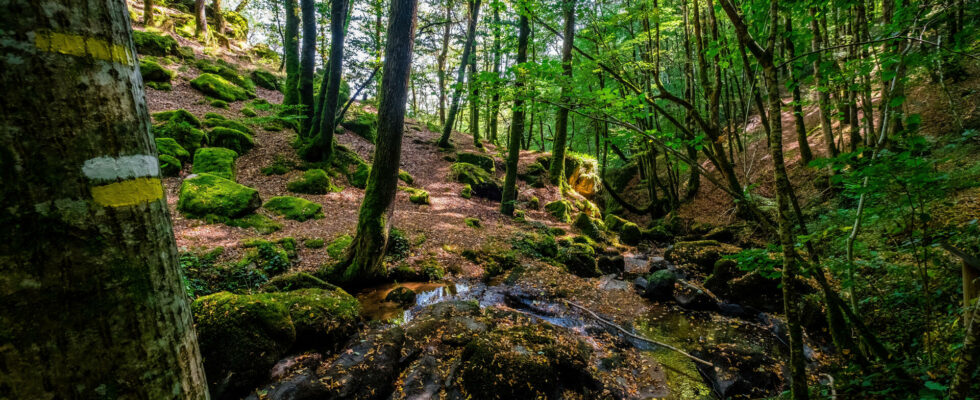
Jean-Marc Chirier decided to make these controversial dams a tourist element. In 2013, he launched the idea of a hiking trail that would connect Confolent-Port-Dieu to Argentat-sur-Dordogne, near the Sablier dam. Between the two, 200 kilometers of trails, fifteen days of hiking more or less closely along the river. Immediately, the municipalities concerned became enthusiastic. Sixteen of them then, nineteen today, are taking part in the adventure. EDF is involved, offering logistical and financial assistance.
On the ground, a team of volunteers is rolling up their sleeves. It is necessary to mark existing paths, create new ones, find traces of the multiple routes used by peddlers, cattle dealers, washerwomen and poachers, obtain authorization from owners to cross their land. Most say yes, although inheritances or sales can then lead to some friction. You also need to find accommodation, camping areas, and a taxi who agrees to forward the luggage or come at the end of the route to pick up the hikers and take them back to their starting point.
You have 63.91% of this article left to read. The rest is reserved for subscribers.