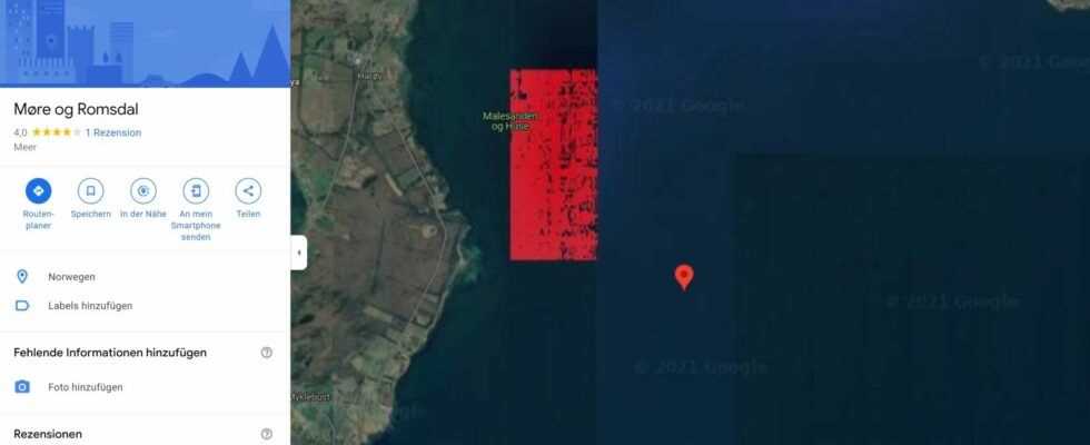
On Google Maps you can see a red rectangle in front of Norway’s coast. It has been puzzling the net for months, we’ll tell you what’s behind it.
The red rectangle off Norway’s coast is always a topic of discussion on the internet. (Source: TerraMetrics, map data / Google Maps)
- A red rectangle can be seen off the coast of Norway.
- This is a nature reserve.
- Why it is shown in red is unclear. There are several possible reasons.
The world can be discovered with Google Maps, but again and again we come across strange discoveries – such as that of a red rectangle off the coast of Norway.
You can see it for yourself if you enter the following coordinates on Google Maps and then activate the satellite view of Google Maps. The coordinates are “62.76341929153397, 6.504527458824456”.
The red rectangle in front of the coast has been puzzling the network for months. Posts on this topic can be found again and again on discussion platforms such as Reddit – most recently in July and December 2021. What does this mean?
The rectangle is labeled “Malesanden og Huse”. This is a nature reserve where wild birds nest. But why does it appear red in Google Maps? This question cannot be conclusively answered.
Why is the nature reserve colored red?
There are several possible answers: On the one hand, it can simply be a display error, on the other hand, it is also conceivable that Google wants to highlight the status of the nature reserve with the marking. On Bing Maps and Apple Maps, for example, the island can be seen without any red coloring.
Google Maps: Curious pictures and creepy finds
Curiosities in Google Maps
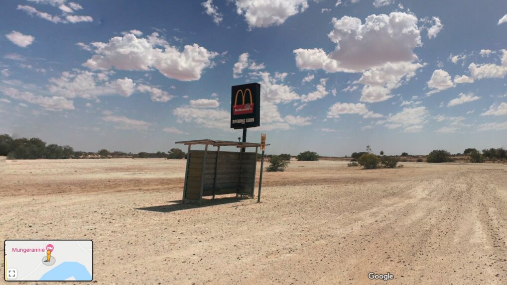
A Mc Donald’s in the Australian outback? Is the group really building a branch here? (Source: Google Maps / Peter Bagusauskas) [Auf einer Seite anzeigen | Als Story anzeigen]
Picture 1/16
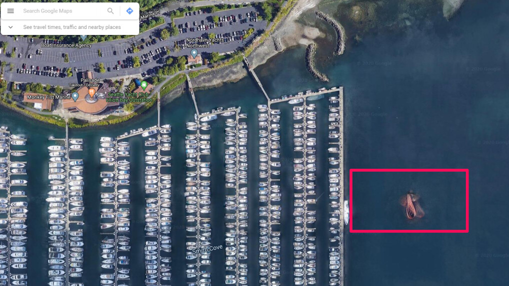
What is swimming in the water? The answer is far less creepy than thought. (Source: Google Maps / Maxar Technologies, US Geological Survey USDA Farm Service Agency) [Auf einer Seite anzeigen | Als Story anzeigen]
Picture 2/16
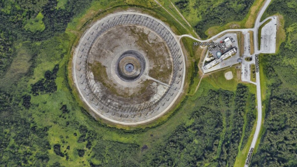
Behind this cage in Alaska is something completely different than expected. (Source: Google Maps / Landsat / Copernicus, Maxar Technologies, Municipality of Anchorage, US Geological Survey) [Auf einer Seite anzeigen | Als Story anzeigen]
Picture 3/16
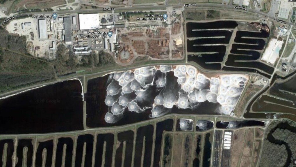
No, these are not giant jellyfish, but something completely different. (Source: Google Maps / Maxar Technologies, USDA Farm Service Agency) [Auf einer Seite anzeigen | Als Story anzeigen]
Picture 4/16
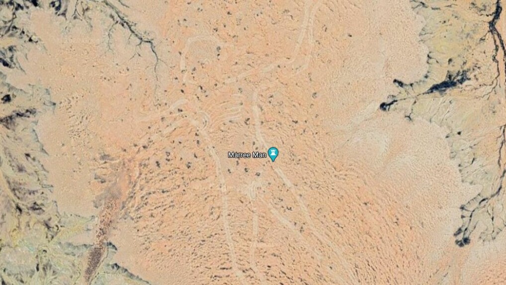
This drawing is not an optical illusion, it really does exist. To this day, however, the Marree Man has given us a riddle. (Source: Google Maps / CNES / Airbus, Maxar Technologies) [Auf einer Seite anzeigen | Als Story anzeigen]
Picture 5/16
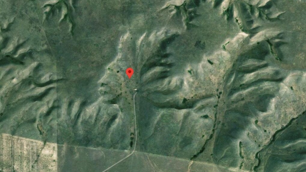
From the air, Canada’s Badlands Guardian looks like an ancient warrior. (Source: Google Maps / Airbus, Maxar Technologies, S. Alberta MD’s and Counties) [Auf einer Seite anzeigen | Als Story anzeigen]
Picture 6/16
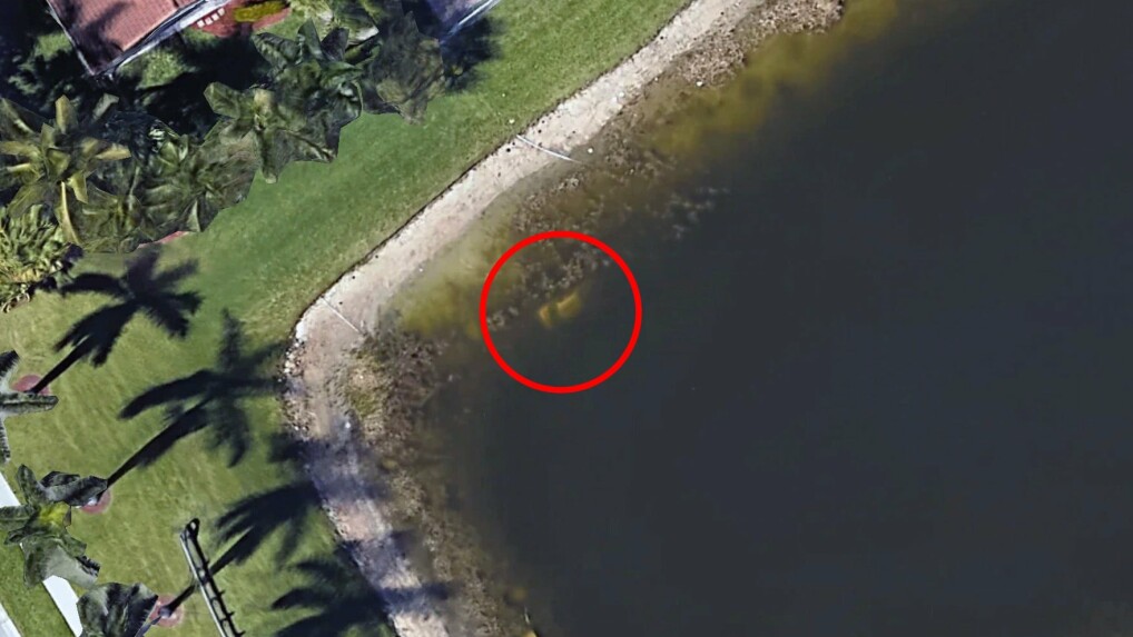
A former resident discovered the wrecked car on an aerial photo from Google Earth. The police made a creepy discovery in it. (Source: Google Earth / Maxar Technologies) [Auf einer Seite anzeigen | Als Story anzeigen]
Picture 7/16
You can discover this kissable mouth in Sudan. (Source: Google Maps / CNES / Airbus, Maxar Technologies) [Auf einer Seite anzeigen | Als Story anzeigen]
Picture 8/16
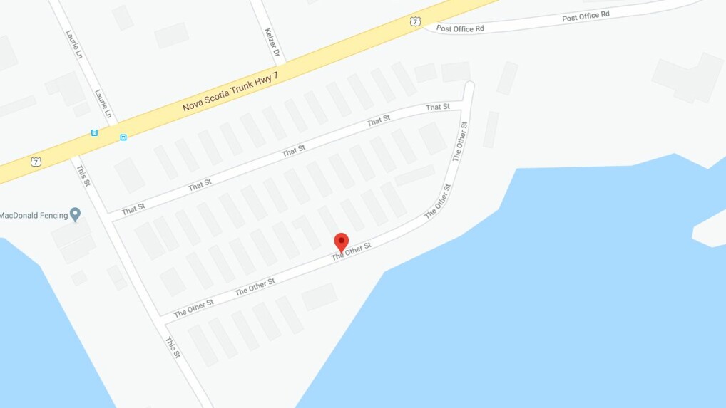
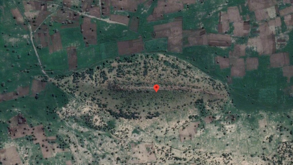
In Porters Lake, the city council has been particularly creative with the choice of street names. (Source: Google Maps) [Auf einer Seite anzeigen | Als Story anzeigen]
Picture 9/16
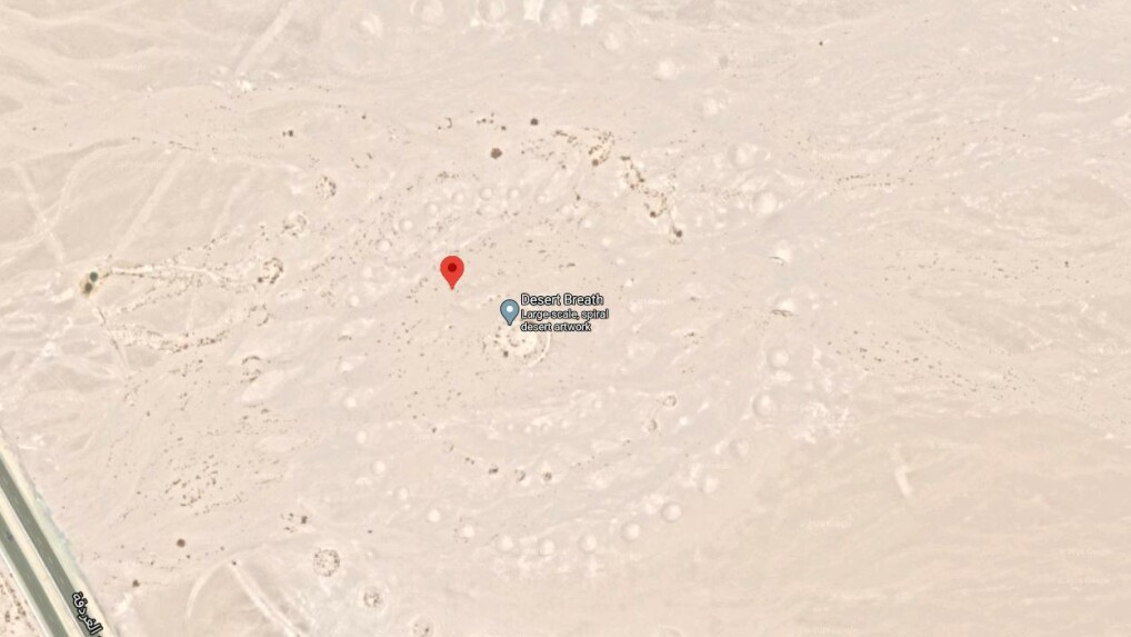
Has a giant sandworm left its mark here? Probably not – the traces are made by human hands. It is a work of art called “Desert Breath”. (Source: Google Maps / CNES / Airbus, Maxar Technologies) [Auf einer Seite anzeigen | Als Story anzeigen]
Picture 10/16
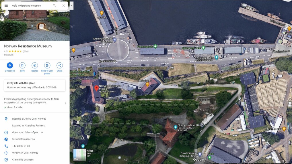
A Morse code has been painted on the street in front of the Resistance Museum in Oslo. (Source: Google Maps / Maxar Technologies) [Auf einer Seite anzeigen | Als Story anzeigen]
Picture 11/16
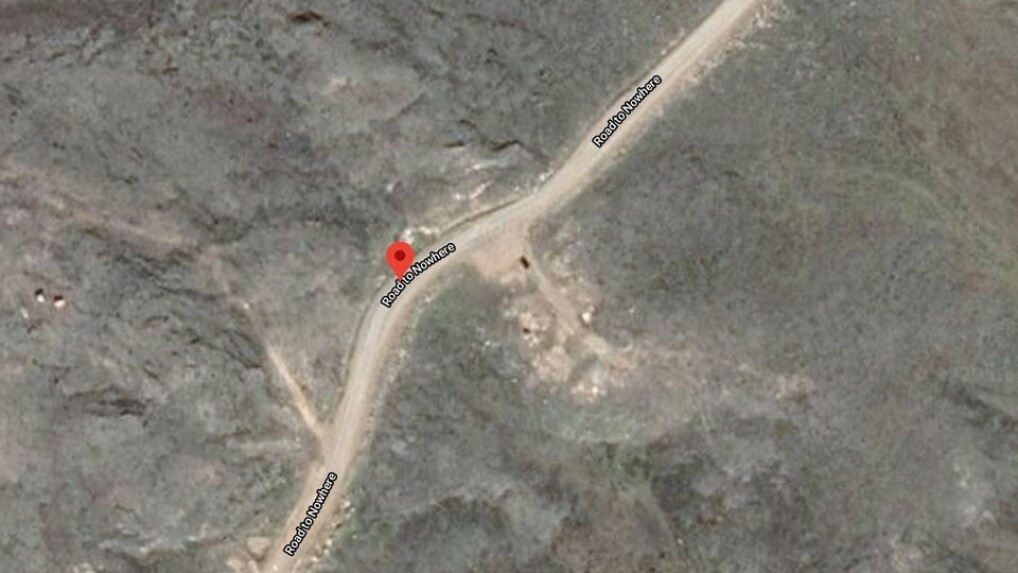
“On the Road to Nowhere” – the street with this name really exists, but what is the end of it, where does it lead to? (Source: Google Maps / CNES / Airbus, Maxar Technologies) [Auf einer Seite anzeigen | Als Story anzeigen] Picture 12/16
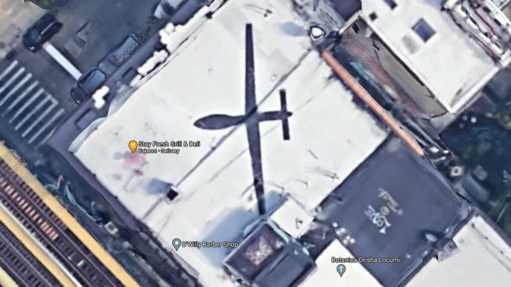
Drone or work of art? This aerial photo from Google Maps is causing wild discussions on Reddit. (Source: Google Maps / Bluesky, Maxar Technologies, Sanborn) [Auf einer Seite anzeigen | Als Story anzeigen]
Picture 13/16
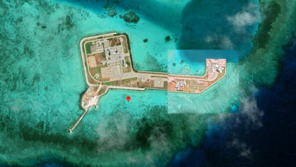
This well-fortified island in the Indian Ocean could have been straight out of a James Bond movie. In fact, it appears to have been built by the Chinese military. (Source: Google Maps / Maxar Technologies) [Auf einer Seite anzeigen | Als Story anzeigen]
Picture 14/16
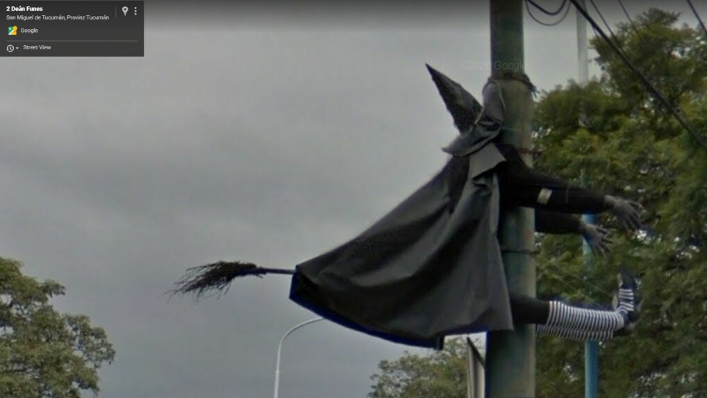
Flying has to be learned, as this witch in Argentina shows us. (Source: Google Maps) [Auf einer Seite anzeigen | Als Story anzeigen]
Picture 15/16
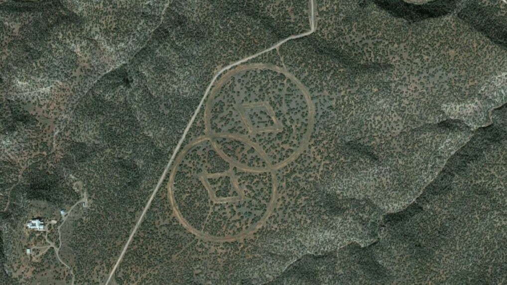
These symbols are designed to guide Scientology founder L. Ron Hubbard the way home when he returns to earth. (Source: Google Maps / Maxar Technologies, NMRGIS, USDA Farm Service Agency) [Auf einer Seite anzeigen | Als Story anzeigen]
Picture 16/16
In addition to the red rectangle, there is also a secret code to discover in Norway. Can you decipher the message in Oslo?
” Tip: The best VPN providers for more security and data protection