Cycling is made up of unforeseen events, that’s what makes it so charming, but if we can reduce the risk of hitting a big national road or getting hungry in the middle of nowhere, that’s better, right? Follow our guide to get started on the trails and find the right resources, in all seasons (we still prefer spring and summer).
When you just want to cycle somewhere else, explore other horizons, the fear of getting lost is a hindrance. And the question “well where are we going to ride?” » is another.
We are lucky in France, there are many marked cycle routes which allow you to enjoy a bit of your local area on weekends or on vacation. These routes are not always exclusively cycle-friendly. They pass through cycle paths, shared roads (cars, pedestrians) and greenways (my favorites). You will therefore sometimes have to share the road with other users.
To you cyclist who is afraid to take the plunge, to you who wants to ride on beautiful roads, to you who wants to show your e-bike that there is something other than the city, I am speaking to you . To you who only ride at 35 km/h and for whom the average is sacred, to you who want to see what your electric road bike has in its belly, you are welcome too, but you will be better on the road.
That being said, here is how I go about finding safe cycling routes and riding (with peace of mind). Some bonus tips at the end of the article.
My sites to find reliable and safe cycling routes
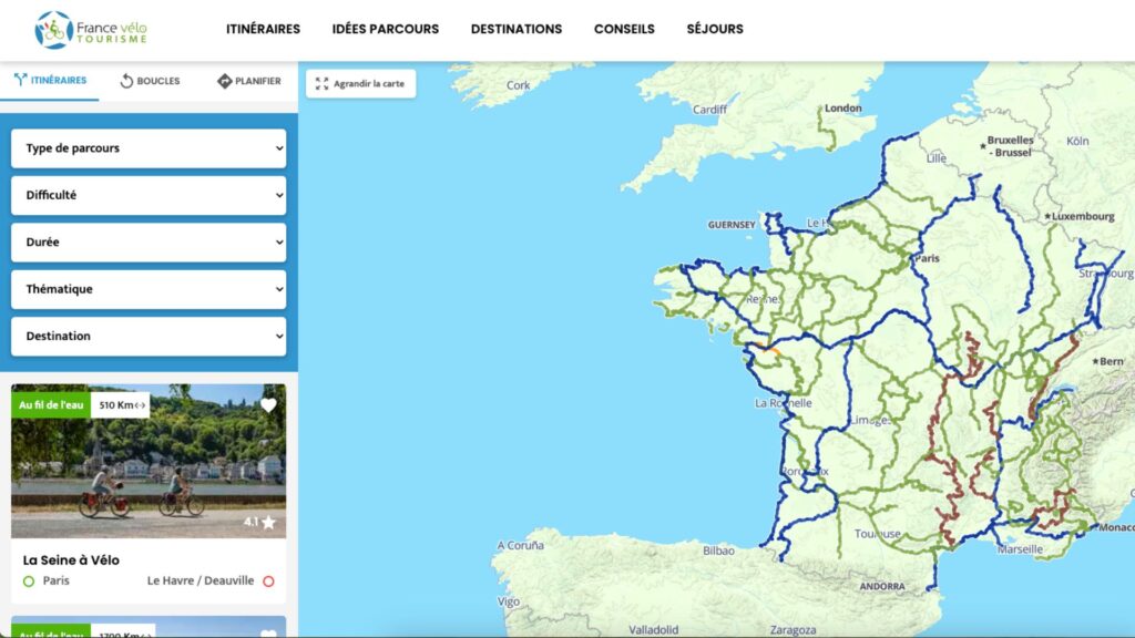
The France Vélo Tourisme website
This site is a bible and their route plannera nugget. I find it very well done. The map allows you to have a quick overview of the major cycling routes (EuroVelo, La Seine à vélo, cycle routes, La Vélodyssée, etc.) which pass through your city or nearby.

What I appreciate is filters to find your route (level, desire, geography, time, etc.). Limit of the planner, it considers an entire route (departure-arrival) over time while it is entirely possible to only complete a portion of it. For example, if you use filters [je débute/en famille] And [une journée], this reduces the scope too much. I therefore advise you to then look on the itinerary sites which often offer divisions (I am thinking of La Seine en Vélo).
The advantage of these bicycle routes (cycle routes, cycle routes, national routes, Eurovélo) is that most of them are marked by signs.
From the site, you can also directly download route maps in GPX, a file format that combines location data, geographic coordinates and points of interest. You will need this to use your GPS or a GPS app.
You will also find other practical information on the France Velo Tourisme sites (stations along the route or to access it, accommodation with the Accueil Vélo label, etc.) so you can leave with peace of mind.


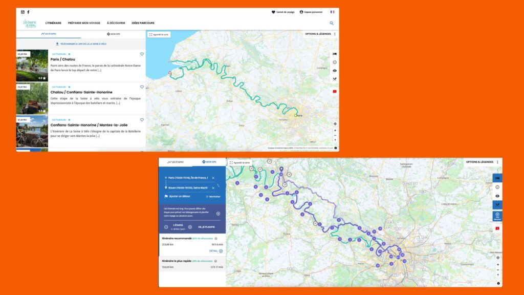
The Seine by Bike: from Paris to the sea with love
Join Le Havre and Deauville by bike from Paris along the Seine. You take almost exclusively cycle routes by choosing the recommended route and following the Seine (risk of getting lost = almost zero). It’s not the fastest, of course, but that’s not the point. We are here to enjoy. To see the country.
It is the ideal cycling route for a first weekend on the bike or a day. Another advantage is that there are numerous stations along the route, so you can easily return by TER. You don’t have to do everything over several days; you can plan several weekends (1 weekend = one stage).
The site automatically offers stages with their mileage. It also allows you to divide your journey into several stages depending on the number of kilometers desired per day.
And of course, the GPX file of the route can be downloaded from the site.


Applications to find and/or take cycling routes
Several applications allow you to trace your bike routes or use those created by the community. The best known are Strava or Komoot. On this subject, Strava announced in January 2024 in a press release that the application brought together “the largest online sports community, with more than 120 million users to date. »
If Strava focuses on the performance aspect, Komoot invites exploration, adventure, and the discovery of points of interest.
The major equipment manufacturers Garmin, Wahoo and Sigma also offer an application to generate and find routes (accessible mobile, desktop and/or both at the same time).
Without saying that it’s random and not very well designed, we sometimes have unpleasant surprises, especially when we let the algorithm plot and calculate the route. Anyone who has never ended up on a national road or a road that doesn’t exist should come forward, I would like to know them and suck a little of their magic from them.
Generally, a little check on Google Street View never hurts. When I map on Garmin Connect (we say that in the jargon), for example, I alternate a lot between satellite mode and the default mode.
Otherwise, there is a very nice and free application that s’apelerio Geovelo for the old and the nostalgic. You can also find safe and reliable cycling routes on their site. And GPX files are downloadable for each route.
Google Maps includes a location sharing feature. Practical and safe if you go riding alone. Watch out for the battery!
The advantage is that you can use your smartphone in GPS since the application integrates navigation. It also calculates the route to take you to the starting point of the walk.
Disclaimer:
Finally, there are of course other options to trace and find routes: Open Runner, Wikiloc, etc. Books and guides like the Recto Verso method map by Les Others, or L’Atlas velo by Claude Droussent.
My other tips before leaving
Buy a GPS
For a few outings, a smartphone is enough but if you liked it, you will like it and I strongly urge you to invest in a bike GPS.
It is more practical for following a route or downloading GPX tracks, YOU save your phone battery (no external battery to carry around, too) and your internet plan. Used or new, we now find models for around a hundred euros.
I personally own the Garmin GPS Edge Explorer. It has a large touch screen, it is easy to get started. We can now find it at €149.
Don’t take a simple meter.
We explain the difference to you in this article dedicated to GPS.
Or download a GPS app
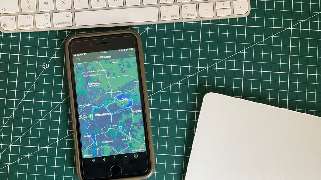
And if you haven’t planned to buy a GPS or want to use your smartphone, I tested an application that allows you to download your GPX file and track your position in real time. It’s called GPX viewer. It is available on the App Store and is free. That doesn’t exempt you from leaving a little tip to its creator Jonathan Gander (or/and a nice review) to thank him.
You can download the GPX file directly by importing the file or copying the URL. It’s very practical. The interface is simple to use. We quickly get our bearings. You can also lock the screen so that it does not turn off when you open a card.
Be careful with the use of your smartphone’s battery though.


It exists an equivalent application with the same name, GPX Viewer, on Android. Not tested here but it is rated 4.5 stars out of 5 by 41.2k reviews.
Take the train
Leaving a big city is often a hassle and not the most fun journeys. What I advise you is to take the train, the TER or any other rail system. In 20, 30 minutes, you avoid the (endless) suburban roads and the peripheral areas, often industrial.
When booking, specify that you have a bicycle. Please note, not all bikes are allowed (tricycle, longtail).
Equip yourself (a little)
Take something to repair a puncture (new inner tube, pump, tire lever). Also, I highly recommend buying shorts. This reduces friction and improves your comfort. And don’t wear underwear underneath. Never.
Before leaving, prepare yourself a little and increase your saddle time to avoid having sore buttocks on the big day. Put on a helmet. Take something to eat and containers of water.
Have your bike or e-bike serviced
This will help you avoid unnecessary mechanical glitches that ruin a day on the bike. Don’t forget to charge the battery of your VAE, or bring the charger if you are going for several days.


Subscribe for free to Artificielles, our newsletter on AI, designed by AIs, verified by Numerama!
Some links in this article are affiliated. We’ll explaine everything here.
