Louise Salle
modified to
07:20, December 07, 2022
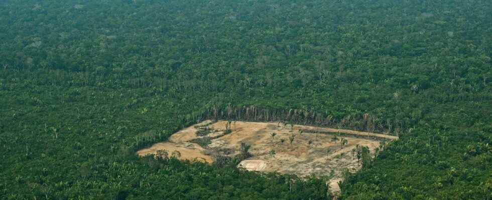
It is a world first. While the COP15 of biodiversity opens today in Montreal, the European Union reached an agreement on Tuesday to ban the import of products accelerating deforestation. Cocoa, coffee, soy, or even furniture… Many everyday consumer items are concerned. Customs will therefore have to check, from 2024, whether imported raw materials do not come from freshly deforested land.
Provide customs with the GPS coordinates of the crop plots. Take, for example, the case of a European chocolate manufacturer that imports its cocoa. Its cocoa arrives by ship at the port of Rotterdam, in the Netherlands. The company that imports it must then present to customs the GPS coordinates of the plots where the cocoa was grown. Customs officers then look, using satellite images, to see if these plots have not suffered deforestation after 2020.
Airbus already specialized
Airbus’ defense and space department has been processing satellite data on forest cover for decades, which could be used by European customs. “Today, we have different sensors that provide images every day and that allows us to understand what are called the biophysical parameters of the plant”, explains Wendy Carrara, head of European relations at Airbus.
“For example, we have information on the leaf surface index, the chlorophyll content of the plant and a whole host of properties that will allow us to identify the type of crops,” she explains. “We will then be able to make the distinction between several plots, to qualify them as forests, fields of wheat, corn or rapeseed…”, continues Wendy Carrara. “We have quite the level of finesse necessary to understand very precisely what is happening at the forest level on a global scale”, she insists.
European and American satellites to map to the nearest hectare
Airbus has 14 satellites that photograph the entire earth. But European customs can also count on the half-dozen sensors of the Copernicus network, and on American satellites, to refine their precise mapping, to the nearest hectare, concerning the state of the forest cover.