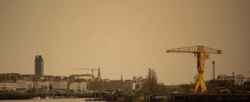
Like an air of deja vu. A new cloud of sand from the Sahara is expected to affect certain regions of the country this Wednesday, April 27. A phenomenon already observed three times in France since the beginning of the year.
This fourth thin yellow-orange film was thus to envelop the south-west of France before going up to Brittany at the end of the afternoon, according to forecasts by Météo France.
“Sandy drops” could also affect Aquitaine and the Pyrenees.
According to the model prediction #MOCAGE #Meteo Francepassage of desert dust tomorrow, Wednesday 27, over the South-West with some deposits on the ground. pic.twitter.com/k0610iXnp0
— Meteo-France (@meteofrance) April 26, 2022
Particles transported by the sirocco
These clouds of sand are transported by the sirocco, a hot and dry wind, which blows on the surface of the ground of the Sahara desert. The smaller particles concentrate in the air, while the heavier ones fall to the ground.

This meteorological phenomenon is repeated more and more. As a reminder, last March, similar episodes were observed.
They were responsible for yellowish marks on the windows of the cars, in addition to plunging the twilight with an orange-yellow sky.
However, this new phenomenon could, still according to Météo France, be less intense than the previous ones. As a result, the sky could only change color very slightly.