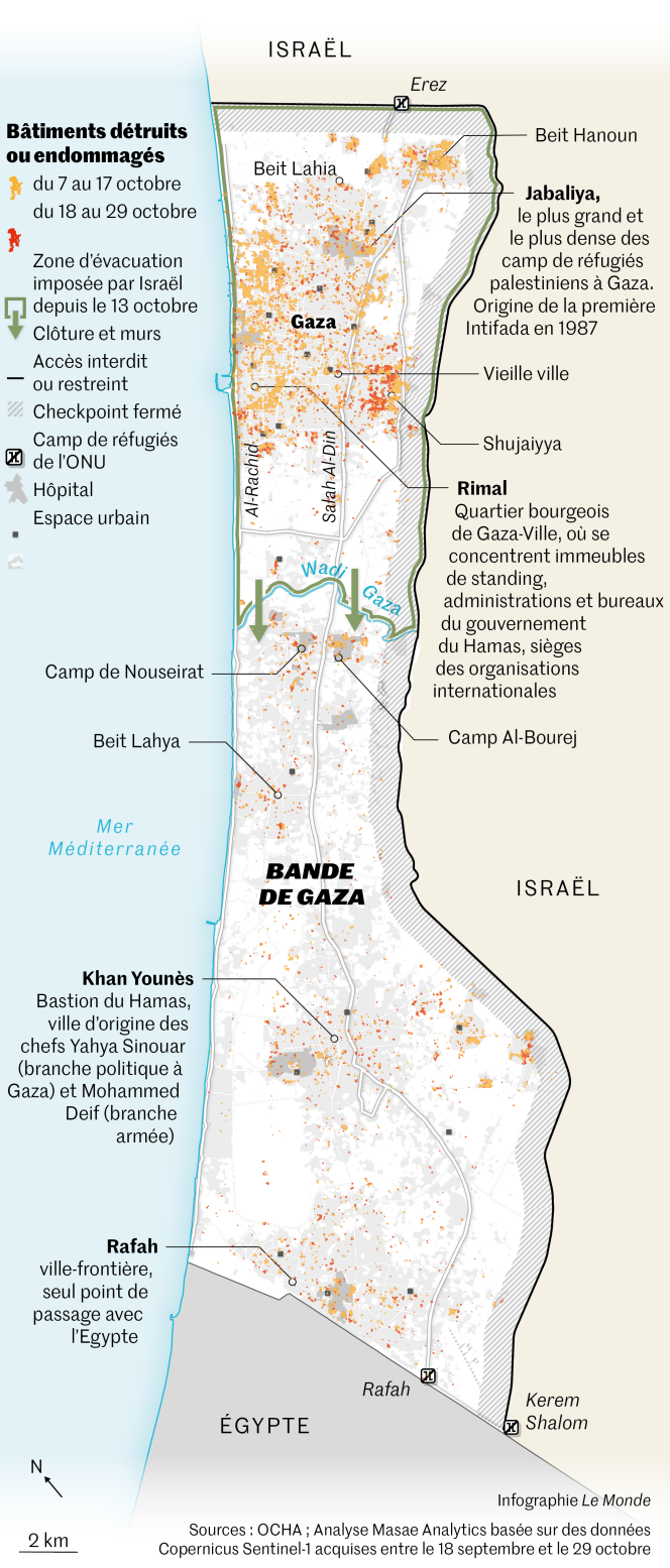
The military offensive against the Gaza Strip, launched by Israel in response to the Hamas attack on its soil on October 7, entered a new phase since Friday October 27. Air strikes increased, particularly in the north of the enclave, and land operations began after several days of occasional incursions carried out by the Israeli army.
The infographics service of World, based on images taken by the Sentinel-1 satellite of the Copernicus program processed by the specialized company Masae Analytics, produced the map of the destruction observed between October 7 and October 29 at the beginning of the afternoon. This data only includes built-up areas – parking lots, cultivated areas, destroyed roads and bridges are not represented.
Contribute
The contributions area is reserved for subscribers.
Subscribe to access this exchange space and contribute to the discussion.