contents
In the coming days there will be repeated precipitation, from Friday there will be snow down to low altitudes. Frost must also be expected from Sunday, severe frost is possible on Monday.
the essentials in brief
- Always wet until Saturday
- On Friday and especially on Saturday snow showers down to the lowlands
- Larger amounts of snow and increasing danger of avalanches on the northern slope of the Alps
- Frosty nights from Sunday
Finally rain again
After the extreme drought for practically the whole month of March, widespread precipitation finally falls again by Saturday. But there are also longer dry phases in between. The expected amounts of precipitation alone will probably not be sufficient everywhere to end the drought. In the course of the coming week, however, there is likely to be heavy precipitation again.
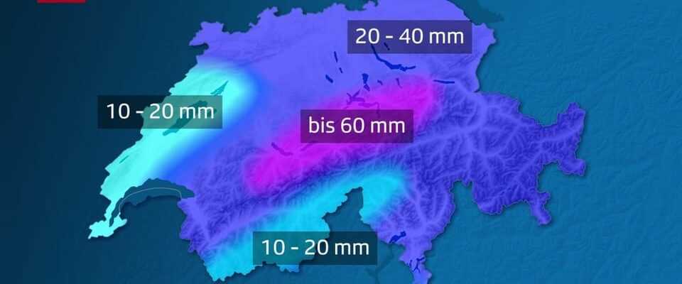
Legend:
Expected totals from Wednesday through Saturday.
SRF Weather
Snow down to the lowlands
On Thursday the snow line is around 1300 meters. It usually drops below 1000 meters in the late evening and on Friday night. On Friday morning there could be snow in the west and north-west at around 400 meters down, otherwise the snow line is usually between 600 and 1100 meters. Colder air reaches us again during the course of the day, and the snowfall level usually sinks to the lowlands by the evening. Also on Saturday there are flakes down to the lowest altitudes. However, the snow does not stay on the relatively warm ground immediately, but in the event of a heavy snow shower, wintry road conditions are also possible temporarily in the lowlands.
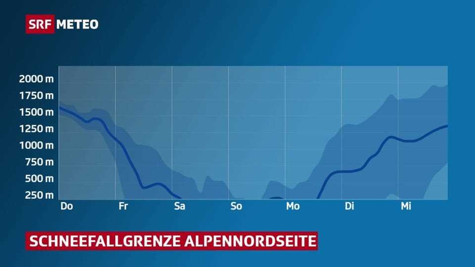
Legend:
The blue line shows the expected snow line, the area the area of uncertainty.
SRF Weather
Large amounts of snow on the northern slopes of the Alps
In the Alps, most of the precipitation falls in the form of snow. There will be 50 to 70 centimeters of fresh snow on the northern slope of the Alps until Saturday evening, while 20 to 50 centimeters can be expected in the inner Alps. The avalanche danger increases.
Significant drop in temperature
Temperatures of up to 22 degrees were still reached in Switzerland on Monday of this week. It will get colder by the day until the weekend. On Saturday, the maximum temperatures are only around 2 degrees. From the weekend the nights will also be frosty. Sensitive plants should be protected. The coldest, with lows around -5 degrees, is expected to be Monday night.
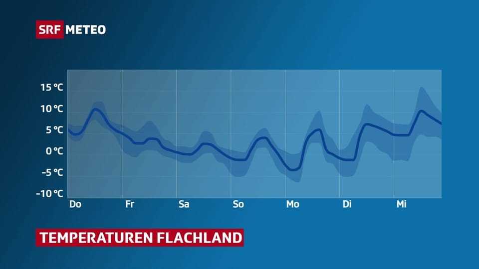
Legend:
Frosty nights from Sunday
SRF Weather