Some elements on SRF.ch only work with JavaScript activated.
Contents
It snows at times even in the lowlands. Winter road conditions already exist in slightly elevated areas. At first there will be stormy winds in some areas.
- In many places on the weekend Danger of slippery conditions due to snow or freezing wet conditions
- In eastern Switzerland and the Alpine valleys early Saturday Gusty wind from 50 to 80 km/h
- Until Sunday on the northern slope of the Alps Amounts of fresh snow
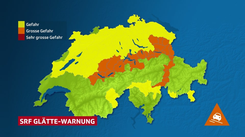
smoothness
Today it is snowing at times even in the lowlands. Precipitation will be widespread, especially in the afternoon, sometimes in the form of rain in the lowest altitudes. Even if it doesn’t turn white everywhere, slippery roads can still be expected at times: on the one hand due to slippery snow and on the other hand due to freezing wet conditions during the night. Above 600 to 700 m, wintry road conditions are to be expected.
Legend:
Freezing warning from SRF Meteo. There is a risk of slippery conditions in the yellow regions, while slippery snow is likely to be widespread in the orange regions.
SRF Meteo
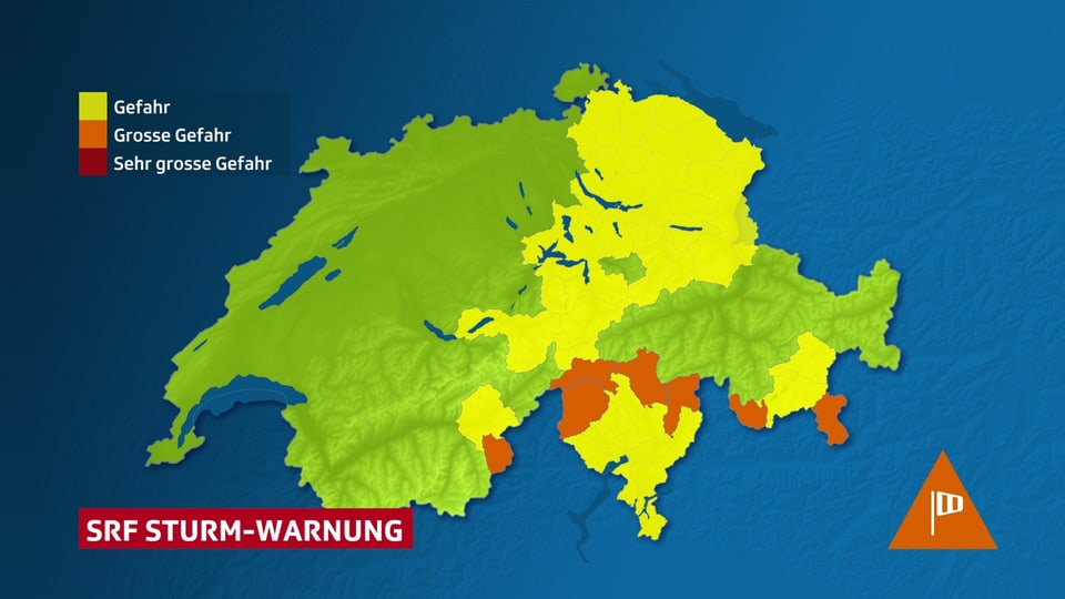
wind
On Friday, strong northern foehn will rage in the south with gusts of 60 to 100 km/h. In Biasca/TI it even reached 22 degrees. The maximum of the northern foehn is expected on Saturday night. In eastern Switzerland there is a strong westerly wind with gusts of around 60 km/h. In the evening and night of Saturday there will also be some squalls in the central and eastern foothills of the Alps and Alpine valleys as well as in the Upper Valais.
Legend:
Wind warning from SRF Meteo. In the yellow areas the wind is strong, in the orange areas it sometimes reaches gale force.
SRF Meteo
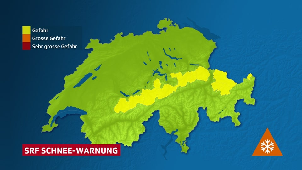
Large amounts of fresh snow
On the central and eastern northern slopes of the Alps, 30 to 70 cm of fresh snow will accumulate by Sunday morning. The danger of avalanches is likely to increase accordingly. Avalanche information can be found here.
Legend:
In the yellow areas, 30 to 70 cm of fresh snow is expected over the weekend.
SRF Meteo
And what happens next week?
Unstable and wintry: one depression follows another. There will be strong westerly winds on Tuesday and again on Thursday and Friday. In between there are north and south foehn phases. The air remains cool, so there will be snow at times down to low altitudes.
Meteo, 11/24/23, 1:00 p.m.; SRF Meteo
Most read articles
Scroll left
Scroll right


Social login
For registration we need additional information about you.
* #socialRegistrationForm * * firstName * * lastName * * emailAddress * * displayName * * mobile * * addressCity *
*/socialRegistrationForm *